ONT Flight Tracking System
To launch ONT WebTrak click here: https://webtrak.emsbk.com/ont4
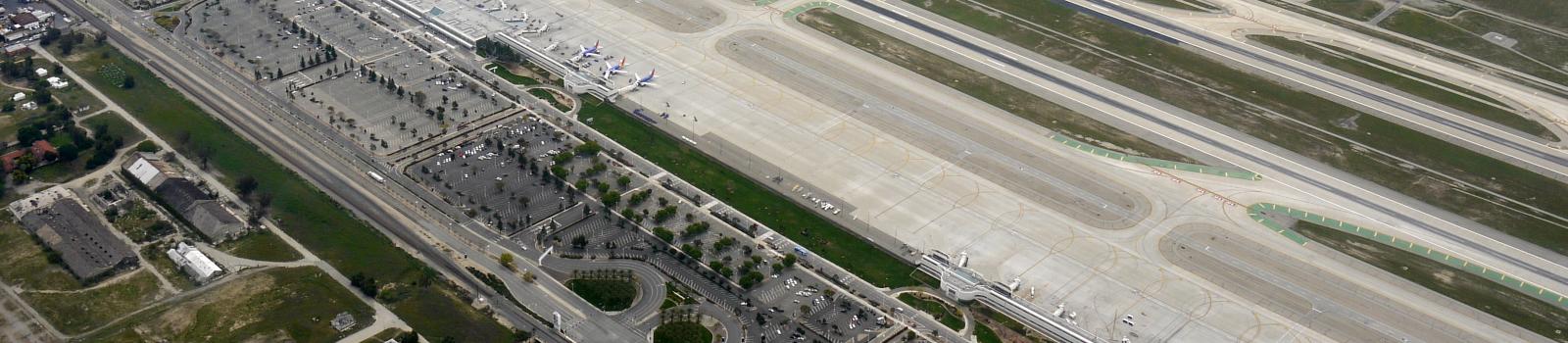
ONT WebTrak Flight-Tracking and Noise Information
Welcome to ONT Flight Tracking System using Lochard’s WebTrak. WebTrak is a system that allows you to watch the movement of flights and air traffic patterns within the Inland Empire and the eastern portion of the Los Angeles area. This flight tracking system includes specific information about flights from ONT, Chino Airport (CNO), Brackett Field (POC), and arrivals to LAX, as well as information on air traffic transiting through the region. Information shown includes the aircraft’s type, altitude, origin/destination airports, and flight identification.
- Green aircraft icons represent departures from ONT.
- Blue aircraft icons represent arrivals to ONT.
- Yellow aircraft icons representing aircraft operation to/from CNO, POC, and LAX arrivals.
- Black aircraft icons represent aircraft operating to or from another airport in the region, or that are transiting through the region and bypassing local airports.
Real time and historical flight and aircraft radar data originate from the Federal Aviation Administration (FAA) ARTS radar system at the Southern California TRACON facility in San Diego. The ARTS data is downloaded and processed by ONT’s Airport Noise and Operations Monitoring System (ANOMS).
Real time data is viewed in the Live Mode and is the “raw” data feed delayed approximately 21 minutes for aviation security reasons and for preliminary system processing. Historical data is viewed in the Replay Mode and is the fully processed data available up to 90 days in the past. For more information, please refer to the Help section of the WebTrak website. Noise data from the numerous permanent noise monitoring terminals (NMTs) located in the vicinity of ONT are available in both the Live and Replay Modes.
If you are a first time user of this system, please take a few minutes to read the “Start Here,” “Legend,” and “Help” tabs in the upper left corner of the WebTrak site. These should assist you in understanding the full capabilities of and how to use WebTrak.
Flight Information
Aircraft icons are not to scale and will change in size at different zoom levels. Flight and aircraft radar data originate from the FAA’s ARTS radar system.
Airline and aircraft type information is encoded in 3 or 4 characters. For the FAA Aircraft Registry, and the list of airline, aircraft type, and airport origin/destination abbreviations, click here.
Noise Complaint Information
WebTrak is the site you can use to file online noise complaints. Click on the “Complaint” tab located in the upper left corner of WebTrak, then click the “Complaint Form” button. You do not have to identify a flight to register a complaint. The Complaint tab will allow you to research the flight track data to find an aircraft operation that may have caused the disturbance you wish to report. If you do find it, WebTrak allows you to submit a complaint for that specific operation and fills in the information automatically. To request a written response from ONT you must provide your name, address, city, state and zip code.
Noise Readings on WebTrak
Noise readings shown on WebTrak at the numerous noise monitors in the vicinity of ONT are real time noise levels represented by the A-weighted sound pressure level reading. A-weighted decibels, abbreviated dBA, are an expression of the relative loudness of sounds in air as perceived by the human ear. These noise levels represent the actual real time sound level at that location at that moment in time, and may be the result of an aircraft flying over or near the noise monitor. These noise levels may also be attributed to community-based noise, such as vehicle traffic, lawnmowers, etc. or just the ambient noise at that location. When using the Replay Mode in WebTrak, the noise events that correlate to an aircraft operation are shown with a square icon.
The real time noise readings shown on WebTrak at the noise monitors should not to be confused with the annual CNEL, or Community Noise Equivalent Level. The annual CNEL is a noise metric used to describe the average sound level during a 24-hour period, averaged over the course of a year, and does not represent the sound level heard at any particular time. In computing CNEL, the total noise energy for each aircraft noise event is counted, with extra weighting added for aircraft noise events occurring between the hours of 7:00 p.m. and 10:00 p.m. (3 times), and 10:00 p.m. and 7:00 a.m. (10 times). This weighting is done to account for increased annoyance during noise sensitive hours when ambient noise levels are generally lower, and people are more likely to be at home and/or trying to sleep.
Computer Requirements
WebTrak is best viewed using a high-speed broadband Internet connection. A dial-up connection may also be used but loading the application and data will be much slower resulting in longer waiting periods, and it will not be possible to use high levels of acceleration when replaying flights.
Your computer should meet the following minimum specifications:
- Windows 7 or later, or Mac OS/X
- 128MB of RAM (256 MB recommended)
- 500MHz processor (1 GHz recommended)
Internet Explorer 10+ or Firefox 50+ are recommended for Windows users, and Safari on the Mac. Other browsers may work but they have not been tested.
Reliability of Radar Information
The intended use of this Web site is to display the general location and flow of air traffic in the greater Los Angeles region. WebTrak information is not intended for navigational purposes or airline schedule information. While ANOMS processes a large quantity of radar data with a very high level of accuracy, in a small number of cases, flight plan and noise data may not be correlated correctly. You may also notice aircraft icons sometimes "dropping off" and/or suddenly doing unusual things. This is especially true in the area immediately around ONT, but could also occur away from the airport as well. These "ghost" aircraft are due to radar and aircraft transponder reflections from the ground and high rise buildings around the airport, and possibly from terrain and meteorological conditions farther away from ONT.
Liability Statement
This web page and the flight tracking information is a public resource of general information. The use of this site is for illustrative purposes only. The Ontario International Airport Authority (OIAA) and Ontario International Airport makes no warranty, representation of guarantee as to the content, sequence, accuracy, timeliness or completeness of any of the database information provided herein. The user of this site should not rely on the data provided herein for any reason. The Ontario International Airport Authority (OIAA) and Ontario International Airport explicitly disclaim any warranties of merchantability and fitness for a particular purpose. The Ontario International Airport Authority (OIAA) and Ontario International Airport shall assume no liability for:
- Any errors, omissions, or inaccuracies in the information provided regardless of how caused; or
- Any decision made or action taken or not taken by the user of this site in reliance upon any information or data furnished hereunder.
To launch ONT WebTrak click here: https://webtrak.emsbk.com/ont4
Flight Tracking System Decode
To decode the AIRCRAFT TYPE click on the following link, which will take you to the ICAO’s website: https://www.icao.int/publications/DOC8643/Pages/Search.aspx. Then enter aircraft type in the Type Designator box and press the Search button.
The FLIGHT ID field may display two different types of information. An “N” number, which is the “tail number” of the aircraft; or it may contain a flight number using a three letter Airline Code. While VNY is not a commercial airport, some charter companies fly under an Airline Code rather than the aircraft’s N-Number.
If you wish to look up the registered owner of a general aviation aircraft that has an N-Number displayed in the FLIGHT ID field, click on the following link: http://registry.faa.gov/aircraftinquiry/NNum_Inquiry.aspx. This will take you to the Aircraft Registration Inquiry page of the FAA’s Civil Aviation Registry website. Click on the “N-Number” link to initiate the inquiry.
To decode the Airline Code in the FLIGHT ID field click on the following link, which will take you to the following website that will allow you to decode this field: https://en.wikipedia.org/wiki/Airline_codes. Click on the letter corresponding to the first letter of the airline code, sort by ICAO heading, and scroll through the list until you find the airline you are looking for.
To decode the ORIGIN and DESTINATION field(s) for U.S. and foreign airports click on the following link, which will take you to the following website that will allow you to decode this field: http://www.landings.com/landings/pages/search/search_ap-ident.html. Scroll down the page until you get the search box (about 1/3 of the way down the page). Enter the 3 or 4 letter airport code in the Airport Codes box and press the Send Query button to find the airport associated with the code you are looking for.